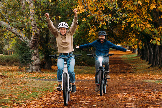
Cycling is one of my favourite summer activities. It’s great exercise, a quick way to get around and see a variety of places, not to mention an absolute blast. There’s something so satisfying about getting home after a long ride and reflecting on the day’s adventures. Luckily for us in Vancouver, we have no shortage of bike routes to choose from. We live in such a beautiful city, it would be foolish not to take advantage of them! If you’re stuck deciding on which bike route to take this summer, look no further. Below I’ll list and elaborate on a few of my favourite Vancouver bike routes starting with the easiest, so you can get off the internet and back on the bike path.
Jericho Beach to False Creek Seawall
Strava data - Distance: 23.6km, Elevation Gain: 109m

This scenic Vancouver bike route begins at Jericho Beach in Kitsilano. This is where I started my ride, however, Vancouver has a large number of bike lanes and roads in most every direction as seen on this map, so you can begin your ride almost anywhere!
The path around Jericho is a gravelly one shared by pedestrians, so be sure to stay alert when navigating this area. Additionally, amidst the shrubbery at the westernmost side of the beach near the kayak rental area, you can sometimes spot a wild hare or two hopping about.
The gravel path turns into a protected bike lane along Point Grey road, and finally exits out onto a shared street when you reach Kits Beach. It curves around the HR MacMillan Space Centre and under the bridges near Granville Island. You’ll likely be sharing the path with a few geese here and there, and see gaggles of them sitting in the green patches near the island. I’ve heard they can be quite vicious when provoked, and have yet to witness it — but I’d suggest keeping your distance, in any case.
Carry along the pathway under Cambie bridge until you reach Olympic Village. You’ll see the iconic Science World globe glistening in the sun.
Here would be a good spot for a cold beer at CRAFT or Tap & Barrel, or an unconventional ice cream at Earnest. There are many benches lining the pathways to sit for a breather and people-watch.
When you’re ready to get back to your ride, simply follow the path around Science World towards BC Place, where you can see Olympic Village from the downtown side of the seawall. This part of the path is usually especially busy on nice days, so watch out for rogue pedestrians and speedy cyclists.
Once you reach Granville Bridge, take a right and a left which will take you towards the entrance to cross Burrard Bridge. This bridge has a small uphill climb before you commence your ride by whizzing down the other side with a big smile on your face.
Stanley Park via English Bay
Strava data - Distance: 22.3km, Elevation gain: 206m

This Vancouver ride is a popular one among all levels of cyclists, and for good reason. It offers a little of everything — cityscape, ocean, and park views make it anything but monotonous. I began my ride by crossing the Cambie bridge and taking the seawall westbound towards English Bay. Signs will direct you to the street just past Granville Bridge as the bike path is closed off for pedestrians, however, the city has blocked off a portion of the street for cyclists. Take this path until you reach the entrance to Stanley Park. Be sure to go counterclockwise around the park to avoid oncoming cyclists.

The bike path at Stanley Park is usually adjacent to the sidewalk which runs around the perimeter of the park, but due to COVID-19 and with the goal to limit traffic in these areas and promote social distancing, bikes must now share the road with vehicles. This road was initially closed off to cars completely, but recently has opened back up with the addition of traffic cones to create a temporary bike lane.
Curving around the east side of the Lost Lagoon, you’ll come to a traffic circle. Take it to the right towards Stanley Park Drive, unless you’d like to cut your ride short by a few kilometres.
To your right, you might be able to spot the downtown Vancouver skyline through the trees that come between the road and pedestrian pathway. The trees begin to thin out as you pass the Naval Reserve, and around Hallelujah Point is where I like to stop for a rest. This is a great spot for a picnic with a friend, or to simply take in the downtown Vancouver views from a new perspective.
When you’re ready, continue the path around Brockton Point and you’ll come across the views of North Vancouver and Lions Gate Bridge.

A little further up the street you can spot the ‘Girl in a Wetsuit’ statue. Atop her head is prime real estate for gulls to take a rest.
You will eventually come to a large cedar tree stump to your left. At this point is where the path curves a sharp left. You’ve likely noticed it’s becoming harder to pedal (without an e-bike, that is).
Take a break for a picture above the Lion’s Gate Bridge: you’ve earned it! A few pedals further and you’ve reached the top of the hill. Just around the corner is a cafe where you can stop for ice cream, or an espresso-based beverage.
Now comes my favourite part of cycling: getting to zoom down the hill! This one is especially rewarding as you gain significant speed on the way down. I’ll be honest, I’m focusing less on the scenery and more on the road at this point, although if you can glance to your left about one kilometre along you’ll notice a famous Vancouver Stanley Park landmark — The Hollow Tree.

You’ll soon reach the bottom of the hill, and arrive back where you started at the entrance to Stanley Park. Last time I did this ride, there was a beautiful sunset at English Bay on my way home which made for some amazing photographs from the Burrard Bridge. Can’t get enough of the gorgeous views in Vancouver!
Iona Beach via Heather St Bikeway
Strava data - Distance: 42.4km, Elevation gain: 239m

This Vancouver bike route has some ups and downs on the way there, but the beautiful beach at the end makes it all worth it!
I began my ride by using the Heather Bikeway, although as mentioned, there are many bike streets in Vancouver.

The bikeway starts in a residential area. You’ll pass many parks, schools, and neighbourhoods along your ride. This bikeway does weave in and out of a few streets, so make sure you pay attention to the green signs leading the way.
Once you arrive near 49th Street, you’ll be able to coast all the way down to the very end of Heather Street, just beyond Marine Drive. At the end, you’ll hang a left, seeing the entrance to the Canada Line Bikeway bridge to your right. Take this bridge all the way across the Fraser River. Here is where I hauled out my GPS.
You’ll eventually make it to Bridgeport Road. It’s a busy road for bikes — be safe! You'll cross a small bridge across the Moray channel and end up on Sea Island: home of the Vancouver International Airport (YVR). Just off the bridge you’ll see a pathway through a grassy area beyond the barrier to the right. Follow your GPS along Airport Road, which turns into Grauer Road, and then take a right on Ferguson. You can turn off that GPS now, as this is the home stretch to Iona Beach!

It’s a fairly long road, but a flat one. You’ll be surrounded by grassy fields, bushes, and buzzing bees until you reach your destination. On the left just before the main parking lot is Iona Jetty — a long, man made 4 kilometre breakwater. There’s no cycling allowed on this pathway, so if you choose to walk it, be prepared for a 2 hour round-trip.
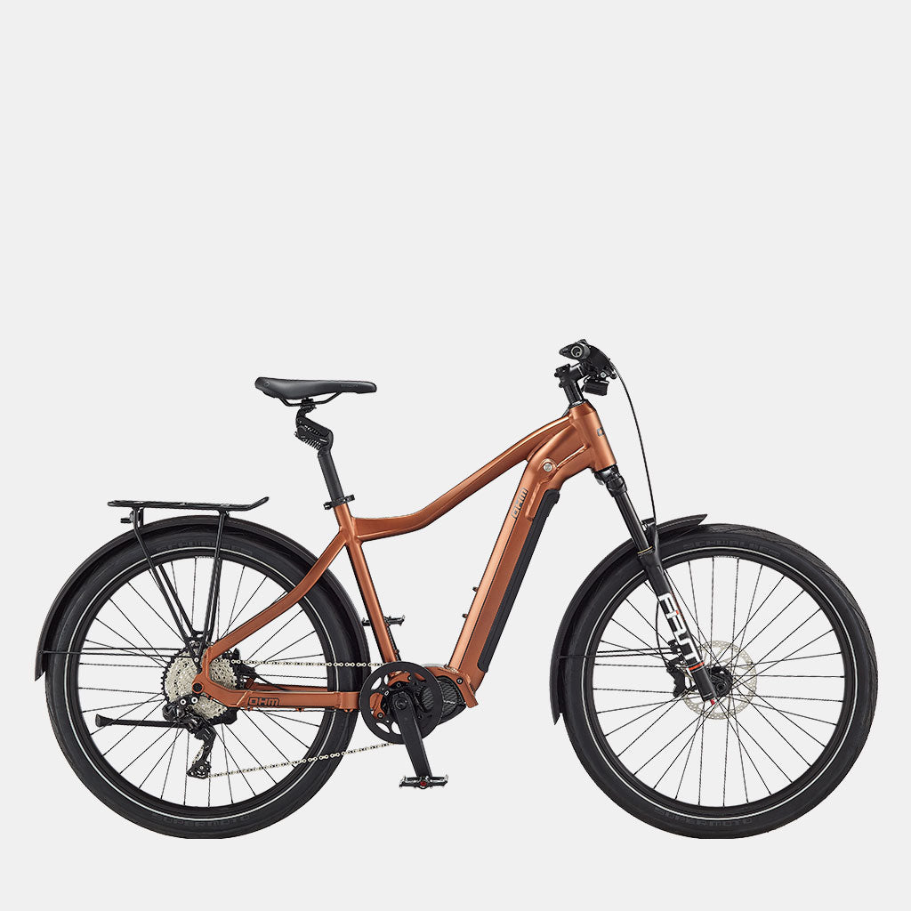
Iona Beach is a large area, making it perfect for physical distancing between visitors. There’s another gravelly pathway on the North end of the park leading to another section of the beach. The terrain is a little bumpy with rocks, roots, and grass, so I’d only recommend this path if you have a hybrid or mountain bike (check out the Quest — a perfect bike for this route). Don’t be like me on my road bike — I let curiosity get the better of me and ended up with a flat tire!
Lighthouse Park
Strava data - Distance: 49.5km, Elevation gain: 605m

This Vancouver ride, on the other hand, is perfect for a road bike! It boasts some breathtaking views throughout the ride right up until your destination at Lighthouse Park near West Vancouver. I decided to return a different way than I started to create a loop around downtown and Stanley Park to make things interesting.
I started this ride by taking the 7th Avenue bikeway to Cambie bridge. Following the Smithe St bike lane to Granville, you’ll take a right and then a left onto the Dunsmuir bike lane. This will turn into Melville St where you’ll loop around to the right and take a left on West Pender which turns into Georgia Street — the busy road that crosses the Lion’s Gate Bridge. Be mindful of traffic here.
You can opt to take the shorter route straight across the bridge, or go through Stanley Park for a more scenic route. I decided to do the latter for this ride, taking the Stanley Park exit to the right. You’ll come to the same traffic circle in ride number two above — take it the same direction to the right and around Stanley Park.

Instead of continuing on Stanley Park Drive like before when nearing Lion’s Gate Bridge, follow the road straight ahead and you’ll go up a short hill to the start of the bridge. Watch for pedestrians as this path is shared, and don’t forget to take a picture or two on the bridge!
This one is really fun to fly downhill, but be sure to slow down at the end as you’ll be coming to a sharp right turn which will take you to the Spirit Trail. You’ll follow the path West under the bridge and take Bridge Street across the Capilano River around to Ambleside Park. This is a beautiful spot to stop for a sip of water, or a light snack to refuel.
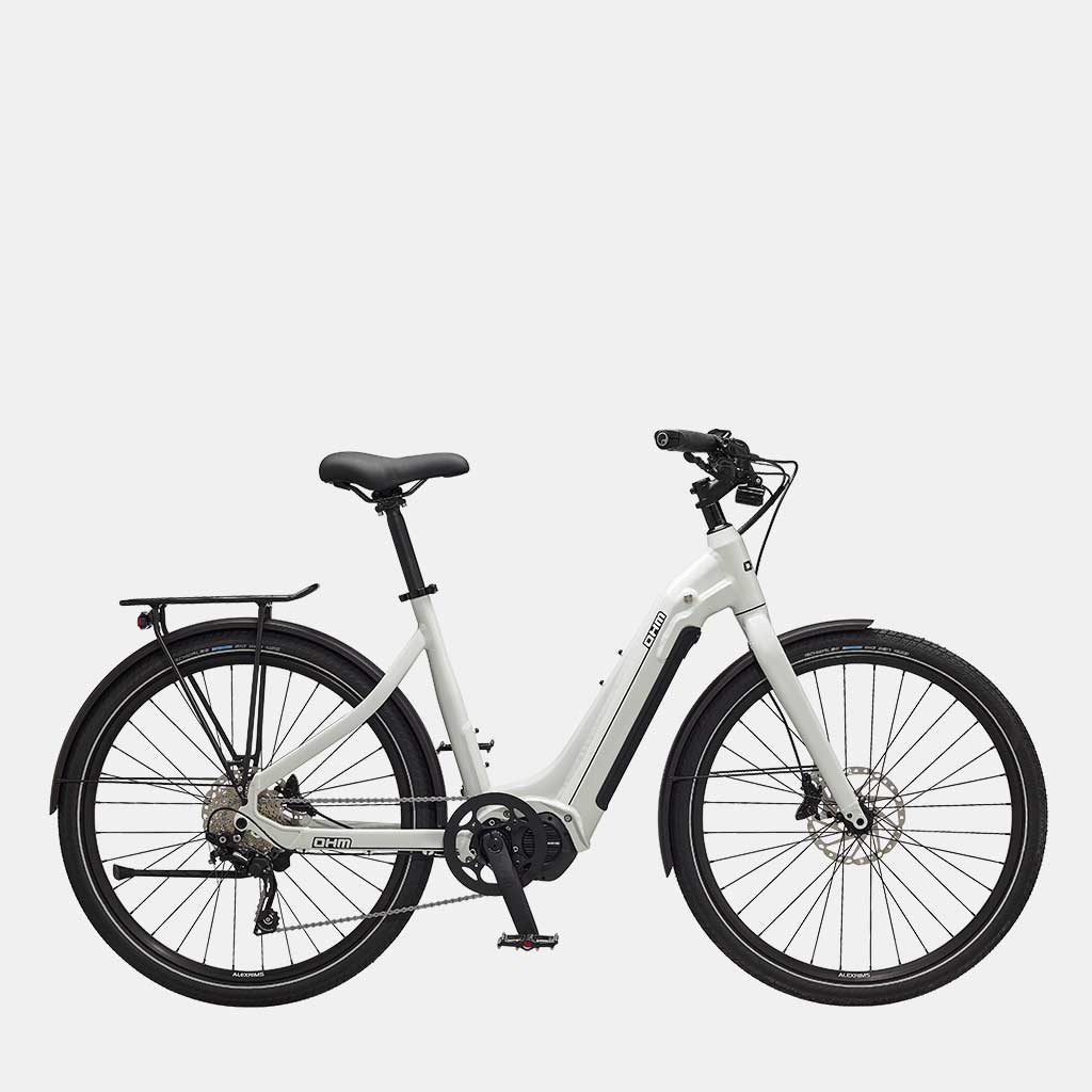
Continuing on your ride, you’ll take Bellevue Avenue beside the train tracks which turns into Park Lane, and eventually Marine Drive. This route has many small hills, so opting for an e-bike like the Cruise would make this ride a breeze so you can focus on the beautiful surroundings!
You’ll be riding past many large houses with magnificent views. Many were for sale. It’s fun to dream about what it would be like to live in them.

Just past Caulfield Cove, you’ll see a small road called Beacon Lane to your left. Take this road to the parking lot of Lighthouse Park. You’ll have to lock your bike at the trailhead, as there’s no cycling down to the beach.
There are some gorgeous views of the city from the bluffs on the waterfront, so bring a blanket to have a picnic here. Be sure to spend an hour or two exploring the trails and viewpoints before turning back for the ~25 kilometre ride home.
The route home is mostly the same, although I opted to take the road down the other side of Stanley Park and through English Bay and the West End to the Burrard Bridge to switch things up.
Vancouver Loop via All the Bridges
Strava data - Distance: 52.1km, Elevation gain: 522m

As the final Vancouver ride on the list, I’ve made sure to save the best for last! This bike route is awesome because you get to see so many different neighbourhoods in Vancouver. It’s like a mini expedition!
Like other Vancouver routes on this list and due to the location of my home, I began the ride by crossing the Burrard Bridge and following the path through English Bay to Stanley Park. I took the long way around Stanley Park again, yet you can cut through the centre if you wish. Once across the Lion’s Gate Bridge, take the bike exit to the right and follow the road back the same way you just came.
This time however, you’ll be taking the Spirit Trail to the East. Be wary of speed bumps as this trail is shared with pedestrians. I actually wiped out on them at this part of the ride — the small loop on the top left corner of the map is my detour to acquire a large bandage and disinfectant. Don’t be like me — always pack your own first aid!
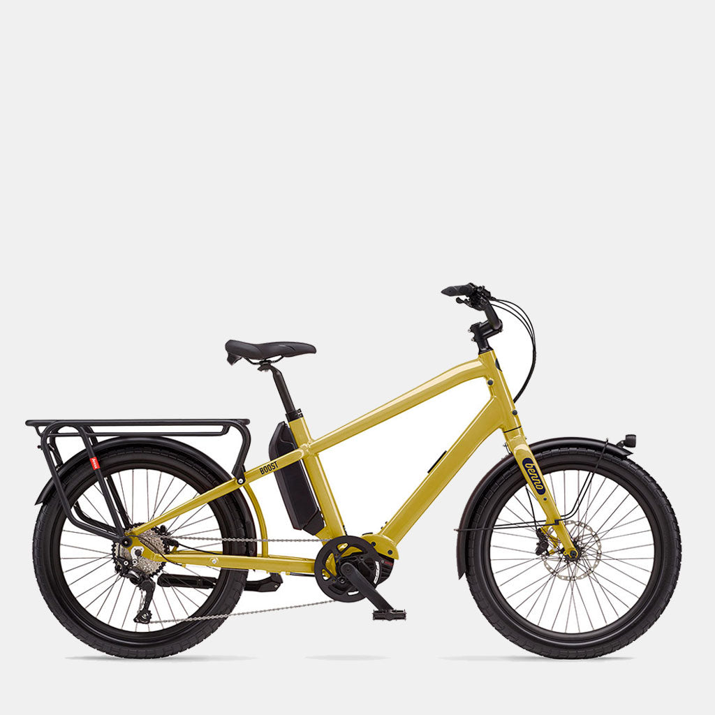
The ride continues along through Welch Park and follows the coastline through Kings Mill Walk Park. Here I spotted a couple of OHM Discover e-bikes happily out for a summer’s ride!
Speaking of OHM, if you take the second exit to the left onto Harbourside Drive, you’ll find yourself at the OHM factory store. Don’t forget to stop by to say hello!
Here you’ll also find world-class chocolatier and patisserie, Thomas Haas. Gobble down a pastry for a short refuel before continuing — I promise you won’t regret it.

Hop back on to the Spirit Trail beside the coast. This smooth trail offers some incredible views of downtown Vancouver as you arrive at Lonsdale Quay. If you didn’t manage to grab a dessert at Thomas Haas, you’ll definitely be in the mood for some ice cream here!
Continue your ride along the Spirit Trail. The trail eventually stops and you’ll have to ride on the road with the cars along Main Street. Eventually you’ll come to the Ironworker’s Bridge which has a separated bike lane. This one is uphill for a good part of the way — relish in that leg burn!
Take the exit just across the bridge to the right. It zigzags down and around to Bridgeway Street. Welcome to East Vancouver!

Bridgeway Street continues along between a few parks and eventually turns into Wall Street. Continue along this street located next to the Vancouver Harbour until you reach Oxford & Cambridge Parks, and take a left down Lakewood Drive bikeway. Eventually you’ll reach Trout Lake around Lakewood & 14th Avenue. I stopped here for a couple pictures and a sip of water. A few dogs were having a blast swimming in the lake.
When I was ready to depart, I unfortunately didn’t see the bikeways from this point, so please follow my route at your own risk. However, the streets I chose were mostly low-traffic and bike-friendly.
I took 15th Avenue Westwards, and then turned left on Findlay Street which eventually turns into Commercial Street. This street crosses Kingsway, so watch out for traffic! Alternatively, the proper bikeway is located at the south side of the lake from 19th Avenue. I curved in and out of a few residential streets in the area, ending up at 33rd Avenue. I would recommend taking the streets a bit further South until you reach the bikeway at 36th Avenue as 33rd can be busy.

I ended up at the bikeway on Winsor, and took 37th Street East through the Mountain View Cemetery to Queen Elizabeth Park. This one has a hill, but the views of downtown Vancouver with the North Shore mountains in the background is worth it! I stopped here for a drink, snack, and a bathroom break before continuing on down the hill on the other side.
Heading North now along Yukon Street, our destination is the Cambie Bridge. Once I reached downtown, I was craving some bubble tea which you can see on my route! Otherwise you can take the Seawall bike route all the way to Granville Bridge.
This bridge doesn’t have a designated bike lane, so be careful of cars. If you’ve made it this far, congratulations! This is the last bridge of your journey.
We hope you found this list helpful in choosing the perfect Vancouver bike route. There are so many beautiful bike routes we haven’t included on this list — let us know of your favourite in the comments below. Happy riding! 🚲